Monitoring subnational human developmentCarlos MendezLast updated on May 15, 2026 1 min read Python, Remote Sensing, Spatial inequality GoogleColab GoogleColab GEE VIIRS-like DMSP-like VIIRS DMSPcc MD versionA geocomputational notebook to monitor subnational human development
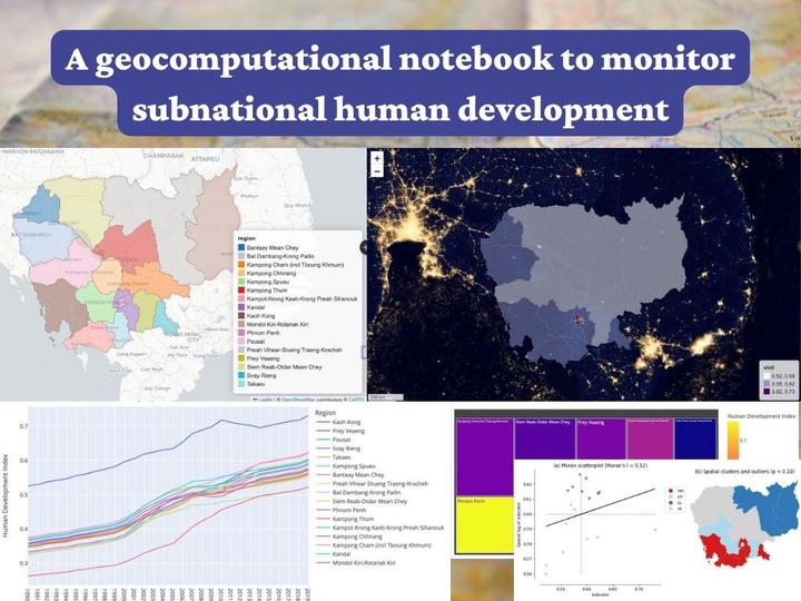
Exploratory data analysisExploratory spatial data analysisSpatial mappingSpatial dependenceSpatial inequalityspatial python regional exploratory data analysis remote sensingCarlos MendezAssociate Professor of Development EconomicsMy research interests focus on the integration of development economics, spatial data science, and econometrics to better understand and inform the process of sustainable development across regions.RelatedMonitoring regional sustainable developmentExploratory Spatial Data Analysis: Spatial Clusters and Dynamics of Human Development in South AmericaExploratory Spatial Data Analysis (ESDA)Spatial inequality dynamicsMultiscale Geographically Weighted Regression: Spatially Varying Economic Convergence in Indonesia